Abstract
The Pocosin Lakes National Wildlife Refuge (NWR) in Eastern North Carolina was established in 1990 to conserve the unique pocosin wetland habitats of the region (U.S.FWS, 2019). Healthy pocosins provide numerous ecological benefits to the Albemarle-Pamlico region in North Carolina. Pocosin wetlands sequester carbon from the atmosphere which is stored in deep layers of organic peat soils. This ability to capture and remove carbon is a key climate change adaptation characteristic (U.S.FWS, 2014a). Pocosins also provide a safe haven for migratory songbirds and habitat for wildlife at the refuge (U.S. FWS, 2014b) and they also help protect water quality (U.S.FWS, 2014a).
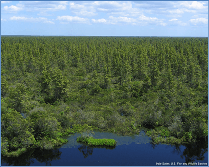
Pocosin Lakes NWR, Picture curtesy of Dan Suter, U.S. FWS
Unfortunately, by 1990 when Pocosin Lakes NWR was established, historic ditching and draining of the Albemarle-Pamlico region had vastly changed the landscape, resulting in the loss of hydric function and alteration of many wetlands, including nearly forty percent of pocosins at the refuge. The loss of hydric function diminishes the ability of pocosin wetlands to sequester carbon and dried out organic soils are extremely flammable thereby posing a wildfire risk during drought conditions (U.S.FWS, 2016). Catastrophic wildfires can turn peat soil carbon sinks into carbon sources. In fact, between 2008 and 2011 four catastrophic fires burned 94,000 acres in the region releasing 20 million metric tons of carbon into the atmosphere (U.S.FWS, 2014a). As such, the U.S. Fish and Wildlife NWR managers have made the “restoration, protection, and enhancement of pocosin wetlands and other natural habitats for optimum biodiversity” a primary goal in order to address these issues (U.S.FWS, 2016). As of 2020, nearly a third of the refuge’s wetlands (37,000 acres) equivalent to 86 percent the pocosin wetland habitat areas that had been highly altered by drainage, have been restored.
Problem Statement: Drained and Dry Pocosin Wetlands
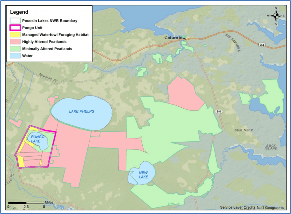
Nearly forty percent of the peatlands at the Pocosin Lakes NWR are highly altered (Map 1; U.S. FWS, 2020). In the past, the land in Pocosin Lakes NWR has been ditched and drained to dry the soil for agricultural activities. This drying diminished available wildlife habitat, pocosin vegetation, and overall wetland function.
Map 1: Pocosin Lakes National Wildlife Refuge Management Areas (U.S.FWS 2020)
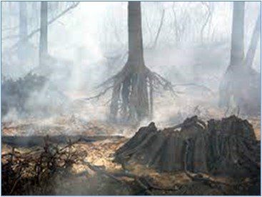
Dried peat is gradually lost through oxidation and also is more combustible and vulnerable to wildfires. The high organic content in peat allows it to burn, sometimes for days or weeks, with increased intensity and duration when wildfires occur. Also, when dried peat combusts, it releases stored carbon into the atmosphere (U.S. FWS 2014a and U.S. Fish and Wildlife Service, 2009a). In June 2008, the catastrophic Evans Road wildfire was ignited by lightning on a nearby property during drought conditions in June 2008. The fire burned over 25,000 acres of the Pocosin Lakes NWR and was not declared officially out until January 2009. Dry organic peat soils smoldered from months, burning deep into the peat soil and leaving the root structures of trees (U.S. FWS, 2009b). Based on the size of the depth of peat burned at the Evans Road fire, it was estimated that the carbon loss to the atmosphere likely exceeded 6 million tons (U.S.FWS, 2009a). Fire not only releases carbon and threatens the habitat, but also releases smoke that impacts air quality and human health through respiratory issues (U.S.FWS, 2016).
Stilted trees resulting from smoldered peat soils in the 2008 Pocosin Lakes Wildlife Refuge Evans Road Fire (USFWS, 2009).
Background: Pocosin Lakes National Wildlife Refuge Habitat and History
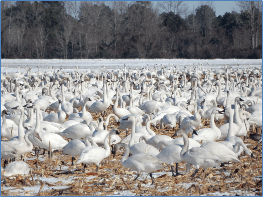
The Pocosin Lakes National Wildlife Refuge (NWR) holds 110,106 acres in the Albemarle-Pamlico region of coastal North Carolina in Hyde, Tyrell, and Washington counties (NC WRC, 2018). The refuge is composed of various habitat types including pocosins, bay forests, peatland Atlantic white cedar forests, moist soil units (managed wetlands), mixed pine flatwoods, hardwood swamp forests, cypress/gum swamps, freshwater marshes, xeric sandhill scrub, cropland, natural lake shore along Pungo, Phelps, and New Lakes, and open water impoundments (U.S.FWS, 2014c). Founded in 1990, the refuge is home to numerous species of resident and migratory waterfowl, reptiles, amphibians, and mammals including the black bear and red wolf. The refuge is a key location along the Atlantic Flyway, providing critical habitat for waterfowl, shorebirds, wading birds, and neotropical migratory songbirds. Tens of thousands of migratory tundra swans and snow geese along with numerous types of ducks can be spotted using the refuge’s open water impoundments during winter months (NC WRC, 2018). Migratory songbirds, like the prothonotary warbler, and year-round resident forest dwelling bird species rely on the vast protected forested and shrub covered areas as a safe haven (U.S.FWS 2014b). The refuge was a chosen site for the reintroduction of the red wolf in the late 1980s, currently thriving on the refuge and surrounding lands (U.S.FWS 2014b).
Tundra Swans at Pocosin Lakes Wildlife Refuge, Picture curtesy of K.Gianopulos
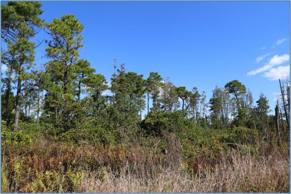
The refuge’s pocosins are the most common habitat, covering close to sixty percent of the land area (U.S. FWS, 2020). Pocosins are wetlands that are raised above the surrounding land surface and often characterized by dominant shrub vegetation occurring on peat soil. Peat is a wetland soil with high organic content due to slowed decomposition of organic material by wet and oxygen-free conditions. Since pocosins are raised, rainfall is the main source of water to the nutrient-poor habitat and the peat soil behaves like a sponge, soaking up the rainwater and releasing it slowly into the surrounding landscape (U.S.FWS, 2016). The naturally slow decaying process in peat soils enables them to sequester, or store, carbon as undecomposed biomass (U.S.FWS, 2016), a process that is also extremely important for climate adaptation (U.S.FWS, 2014a).
Pocosin Wetland Habitat at Pocosin Lakes NWR
Solution: Wetland Hydrology Restoration
The U.S. Department of Agricultural (USDA) designed the pocosin restoration process in 1994, four years after the NWR was established. The Pocosin Lakes NWR restoration project, implemented and managed by the Wildlife Resources Commission, The Nature Conservancy, and its partners, aims to restore the natural hydrology of the wetland by raising the water table. Doing this will restore the essential wetness of the soil, which has been dried out through past drainage practices, in order to sequester carbon in biomass. Habitat will be restored through the revegetation by seeds dormant in the seed bank, since they will be reintroduced to wet soil (U.S.FWS, 2020)
In order to restore the hydrology, water control structures and berms were strategically installed across the wildlife refuge to combat the drainage systems. Halting the water drainage has allowed for normal fluctuations in pocosin hydrology based on amount of rainfall and evapotranspiration (evaporation and water uptake by vegetation, U.S. FWS 2016).
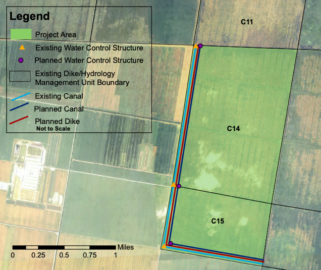
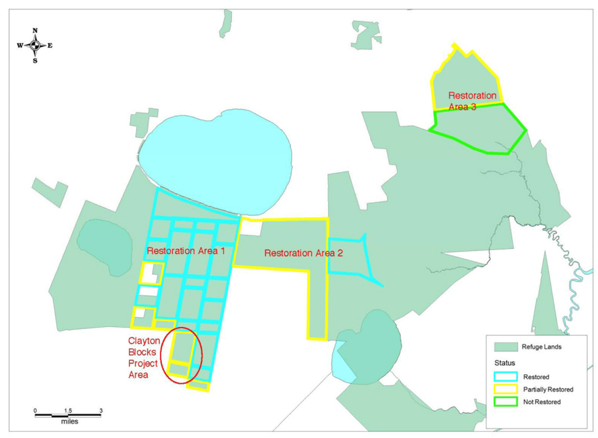
As of 2020, restoration has been completed on 37,000 refuge acres, about a third of the refuge equivalent to approximately 86 percent of the highly altered peatlands (U.S.FWS, 2020). Restoration projects have been done in three separate sections of the refuge (see Map 2). The recent Clayton Road Block project restored 1,325-acre near the the western and southern refuge boundary. Generally, land located within half a mile of the boundary are managed as drier buffer zones to protect adjacent private property from flooding. The Clayton Road Block restoration project used an innovative method to keep the adjacent property safe from water intrusion. An inner canal and berm were installed with three water control structures which allowed soils to slowly rewet and mimic natural seasonal hydrology while protecting neighboring properties (U.S. FWS n.d.)
Clayton Road Block Restoration (U.S.FWS n.d.)
Map 2. Pocosin Lakes National Wildlife Refuges Restoration Areas (U.S.FWS, n.d.)